Friday, January 29, 2016

Marfa Lights, Alpine, Tx & Fort Davis National Historic Site

   
     Well, we've made it into Texas, and despite the cooler weather we've been experiencing, everything is going just fine.  Debbie stumbled the other day and started talking about missing home, but then she looked at the temps up there, compared to down here, and she finally snapped out of it.  A nice dish of Blue Bell ice cream can fix just about anything!  Actually we did some sightseeing yesterday just north of Alpine, TX, and Debbie remembered a soda shop she had read about in Fort Davis, Tx.  And look, we're driving right through the middle of Fort Davis! Can you believe it??  "Park right there" Debbie said, and to my right was the Fort Davis Drug Store, an eclectic soda shop/hotel, located right on the main drag of Fort Davis.
 As we enjoyed our afternoon treat, we struck up a conversation with the owner, originally from Iowa, transplant from North Carolina.  Quite a transition to Texas!  If you've ever traveled through this part of Texas, you'll understand when I say there's not a lot of people out here.  But there are HUGE ranches!  A 30,000 acre ranch is considered a small ranch by the way.  Spread out amongst these ranches are tiny towns, with stores carrying the basic necessities for living out here.  But every once in a while, if you're lucky, you stumble on these little soda shops that remind you of days gone by.
      We passed through Marfa yesterday, which seemed to be a little dot along the highway.  Off of the highway, we spotted a magnificent courthouse, which many of these towns seem to have.  Interestingly, there was a nice bullet hole through the window in the front door.  Bet there has to be a story there!
Of course, everyone knows that Marfa is famous for the  Marfa Lights, a unexplained phenomenon of lights in the desert dancing across the horizon. If you don't, just follow the link, and discover the secrets of Marfa.  And of course, we had to give it a try.  So last night, Debbie and I climbed out of our nice warm coach, and ventured a few miles south of Marfa, to where the State has built a viewing area for all of us tourists in the area.  We waited a couple of hours, but we didn't see anything, which isn't unusual.  They don't appear every night.
Debbie was very brave checking out the viewing stand during daylight hours.  But as soon as it got dark, she was much more comfortable sitting in her locked car in the parking lot.
      We had checked into the Lost Alaskan RV Park, which is located about 2 miles north of Alpine.  It seems to be a stop before heading into the Big Bend National Park, which is about 100 miles to the south.  There seemed to be lots of RV's either heading to or returning from the Park.  The lots are gravel and seemed to be pretty level.  We were escorted to our 90' long pull-thru site, and set up camp without any issues.  The weather was going to dip down into the 20's, so I didn't hook up the water.  I had my tanks full, so it wasn't an issue.
Over in Alpine, we found some beautiful murals painted on the sides of building all over the downtown area.  Dan Blocker from Bonanza days was prominently displayed on one of the murals.  Seems that he was a football star at the local college.

This afternoon we headed out for Alpine and located Kokernot Field, out behind the local high school.  Texas Monthly magazine has described the baseball field as the Yankee Stadium of Texas.  In 1951, 6000 people crammed into this stadium that holds about 1500, to watch Satchel Paige's St Louis Browns play the Chicago White Sox.  The Stadium was built in 1947 for the local semi-pro baseball team, and I'm told, they will be returning to play here this summer.  

     Our next stop for the day was the Fort Davis National Historic Site, located in Fort Davis, Tx.  This fort is the classic example of the Indian Wars frontier military post.  From 1854 to 1861, the soldier of the fort spent most of their time in the field fighting Apache war parties.


     At the outbreak of the Civil War, the fort was abandoned and Confederate Soldiers occupied the fort.  But they soon tired of fighting the Apache's also, and abandoned the fort.  In 1867, the all black regiments known as the "Buffalo Soldiers" returned and rebuilt the fort.  They were eventually successful in forcing Victorio, the Apache leader, to move south into Mexico.  There they were massacred by the Mexican Army.   The National Park Service has done a commendable job in preserving the barracks, officer's quarters and hospital.  There were meticulous records kept by the Army, and the NPS has been able to label each bed with a soldier's name.  The volunteer guide did a great job leading us around the post, and was able to answer each question thrown at him.  Definitely worth a stop if you're in the area.
     Tomorrow we are heading down to the Big Bend National Park for a 4 day visit.  I don't believe there is any cell service down there, so the blog will be a few days behind.  Our campground is putting us right down on the Rio Grande.  Should be a great few days!

Saturday, January 23, 2016

Whitewater Draw Wildlife Area & Tombstone, AZ

     We're finishing up our stay here in Benson, AZ at the Cochise Terrace RV Resort, and if I can get this post done, I'll be pretty much up to date.  It may be tough though.  We spent most of the day out in the great outdoors, got home a little later than usual, and Debbie put together her famous chicken pot pie, and it was delicious.  She added a secret ingredient, potatoes, which she sliced and diced with her new slicer & dicer, but wait, there's more, contraption, that she picked up at the Quartzsite RV Show.  Actually it works very well, and is extremely sharp, so be careful if you ever pick one up.
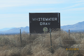
     Isn't that a great RV Park sign.  Drove past it today while visiting Tombstone, and had to stop and get a picture.  But more on that later.  We headed out this morning to visit Kartchner Caverns State Park, which is just down the road a few miles.  As we entered the park, we stopped at the entrance and spoke with the Ranger at the gate.  She then explained that the fee to enter the park was going to be $7.  Then the fee for a guided tour in the cavern was $23/each.  But the kicker was....I wouldn't be allowed to take any pictures.  Seems like the tourists ahead of us were unable to behave, and pushed and shoved each other so bad, that they bumped into each other and the stalactites and stalagmites.  So no more photography.  That was a deal breaker for me.           So we made a graceful exit and headed for Plan B.  The previous evening, up at Cochise RV, we were told of the Whitewater Draw Wildlife Area. Since it was just a short distance from Tombstone (Plan C), Debbie started working the map to get us there.  After turning off the main road, and traveling about 2.5 miles down a dirt road, we came upon the sign above, and to the right we saw a good size parking lot with lots of cars parked there.  This area had once been a cattle ranch but was purchased by Arizona Game and Fish Department in 1997.
The area was now marshland, open water and mudflats, and in the winter, it is home to thousands of sandhill cranes.  There are estimates of 20,000-50,000 sandhill cranes visiting this draw, and we were told it was quite a sight to see.  It seems that the cranes depart the wetlands each morning, and go out in search of food.  They especially like the corn fields.  In the afternoon and evening, they return to rest, only to repeat everything the following day.  Debbie and I parked our chairs along the 1 mile boardwalk set up by the Game and Fish Dept for viewing. As Debbie worked her binoculars, I practiced taking photos of cranes.
 I didn't have my tripod, and I had to maximize the magnification of the camera, which took a little practice to hold the camera steady.  Then suddenly, they started coming home.  Thousands of them, and Debbie and I sat there for hours watching these clumsy birds come down with successful landings.   As the tempo slowed after a few hours, there was a sudden hush from the birds, and we sat there quietly watching thousands of cranes, not making a sound. They were obviously resting.
By late February or March, they'll begin their northward journey home.  Back to northern portions of the U.S., throughout Canada, Alaska, and across the Bering Strait into Siberia, where they'll meet up with thousand of other cranes from Russia and China.  That is truly an amazing feat.  And here we stumbled upon the best viewing area in Arizona.  And this is why we are on this Journey to See America.
     Over the course of about 3 hours, I took 248 photos of these magnificent birds.  I've tried to include a few to give you an idea of what we saw.  If you come to AZ, be sure to come here for an afternoon, and experience the peace and serenity of nature at work.  Here's a link to a great article, for more information on the Sandhill Cranes:  The Wild Bird Store.
     Our next stop would be the historical town of Tombstone, AZ.  The story of Tombstone only lasted 8 years, but it was a wild ride.  The town was founded by a miner named Ed Schieffelin, who discovered a vein of silver while prospecting.  Friends had warned him that all he would ever find would be his own "tombstone", and the rest is history.
The historic portion of Tombstone today plays heavily on the Gunfight at the OK Corral, and there are characters dressed in period costume wandering all over the streets, playing it up for the tourists.  We stayed away from the tourist haunts, and visited the Tombstone Courthouse, which was built in 1882.  Of course it housed the court, the sheriff, and the jail was at the rear.  Tombstone remained the County Seat until; 1929, when it was outvoted by the City of Bisbee.
   
     Inside the museum, I found this U.S. Immigration Service badge, belonging to Jefferson Davis Milton, who, in 1904,  was appointed as "Inspector of Chinese Immigration in a Foreign Country".  His job was enforce the Exclusion Act of 1882, by policing the border south of Tombstone and west to the California Gulf, making him the 1st Border Patrolman.
     Someday when we have more time, we'll have to return to Tombstone, and see what actually happened to this town.
     Tomorrow we push east to Las Cruces, NM where we are hoping to enjoy a great Mexican dinner in Old Mesilla.  Then the following day over to Carlsbad.  Maybe we'll get lucky and start finding some warmer nights to camp in.  

Thursday, January 21, 2016

Sky Island Scenic Byway-Tuscon, AZ

     We took the day off yesterday as Debbie was feeling a little under the weather.  As I recall, our plan was to travel down to Tombstone, but we'll have to check that off the bucket list later on this week. Obviously because of my incredible nursing skills, today she was up and ready to venture out on the road.
     Yesterday while Debbie was convalescing, I struck up a conversation with my neighbor from Colorado, who suggested a drive up the Sky Island Scenic Byway.  It seems to have many names, including Mount Lemmon Scenic Byway, General Hitchcock Highway, or Catalina Highway, but they are all the same place.  One other name you'll see as you start up the highway is a welcome sign to the Coronado National Forest.  This morning we headed out, retracing our steps up to the Saguaro NP, and continuing on toward the Santa Catalina Mountains standing tall before us.
     As we started climbing from the Sonoran Desert floor, we were amazed at the number of bicyclists who were heading the same direction we were.  I was quite impressed since I knew the highway was going to approach the 9000 foot elevation level before ending!  Starting up the highway, we were amazed at the number of Saguaro Cacti covering the hillside.  There were way more than the number we saw in the Saguaro NP, and we wondered why this area, which was right outside the NP, was not included.
The Saguaro's were standing tall as we worked our way up, through hairpin turns, taking the opportunity to stop and enjoy each scenic vista.  There are many of them, and each one gave us a magnificent view of canyon walls climbing straight up, or views out over the massive Tuscon Valley and Rincon Mountains that spreads out below us. There were numerous trailheads along the highway, and I would imagine they would include some incredible views.  The temperature at the base was just about 60, and we anticipated a drop of about 30 degrees before reaching the top.
   
We popped out of the Saguaro's at about 4000 feet, and massive rock formations sprinkled with juniper and pine trees unfolded ahead of us.  There were massive granite rocks with smaller boulders appearing to be balanced precariously on top.  Multiple hoodoos sprang up everywhere among the outcroppings, quite similar to what we encountered in Bryce NP.  Except these appeared to be made of granite instead of the sandstone we encountered in Utah.  


     We knew there was a ski area up on top, and as we climbed, more and more snow could be seen along the highway and up into the forest.  It was a beautiful day, in the mid 50's, and the melting snowpack was filling the canyons with cascading waterfalls and babbling brooks.
 Continuing up in elevation we entered into thick ponderosa pine forests, and passed the turn to Rose Canyon Lake, which was closed till spring.  This 7 acre lake is stocked with trout, and there a campground that's just begging us to stop by.
     Stopping at one of the numerous pull-offs, we found a display from the U.S. Forest Service advising that every 1000 feet in elevation is like driving 600 miles north, and by the time we completed our journey to the top, were were in an environment similar to the Canadian border.  What were we thinking?  Aren't we here to escape the weather up North??
      As we approached the small village of Summerhaven, we spied a right turn directing us up to Ski Valley, the southernmost ski area in the U.S.  We sat in the parking lot, enjoying our lunch and the occasional skier or snowboarder coming down the mountain.  We walked over to the small lodge area and noticed that the chairlift seemed to disappear over the top of the mountain.  Turns out, the chairlift carries skiers up the mountain to about the 9100 foot level, where they can enjoy quite a significant run back to the base lodge.  


     What a delight it was to be able to experience the Sonoran Desert and a Ski area, all in the same day.  With temps in the mid 50's, beautiful sunshine and no wind, Debbie was starting to get the itch to go in and rent a set of skiis, so I knew it was time to get her down off of this mountain. As we worked our way down, we were amazed to see the cyclists, (remember those guys) racing back down the mountain with their GoPro's mounted to their helmets.  I wonder if they all made it down?
     If you get to Tuscon, pack a lunch and come and enjoy this scenic byway.  It's easy to find, and well worth the time.  Bring your skiis or your snowboard if you dare.  The snow was 3 weeks old, and the conditions looked excellent.


Tuesday, January 19, 2016

Benson, AZ - Saguaro National Park

   
     Yesterday we made the 5 hour journey from Ehrenberg, AZ over to Benson, AZ, all interstate driving on I-10.  Traffic wasn't bad for a holiday, (MLK Day), and we cruised in with no problems.  Outside of Tuscon we pulled into a Pilot Truckstop, and after using my Pilot RV Plus Charge Card, I was able to fill Big Red for $1.89/gal!  No one is enjoying the price of oil dropping like a rock like Debbie and I.  When we first started our Journey to See America a few years ago, we were paying over $4.00/gal.  So we were able to travel just over 400 miles for $65.00 in diesel!  Gotta love it.
     We arrived at the Cochise Terrace RV Resort, right off of I-10 in Benson, and were greeted with 2 more terrific deals.  Cochise Terrace is a very nice park, that has a section of park model homes, a section of RV lots that are privately owned, and a section for travelers like myself.  There is a very nice clubhouse with a laundry, pool table, tables and chairs for card games, and multiple overstuffed couches around a very inviting fireplace.  There's a very nice pool out back, but I was told it wasn't heated, so we'll have to see if the weather warms up before I check it out.  A jacuzzi sits right there also, and if it wasn't such a long run from the jacuzzi to Big Red, I probably would have tried that.            Checking in, Debbie was advised that they would accept our Passport America , so we got the entire week here at half price!  I urge everyone to join Passport America, and start camping for half the normal price.  The second deal we received at check-in, was a free dinner here at the Resort. Tonight, they were serving chicken & dumplings and a pudding dessert.  I think I'm gonna like this place. And if anyone has told you about train noise here in Benson, you can throw that worry out the window.  Slept like a baby all night and never heard a train whistle.
     We have a list of several things to do and places to visit while we're visiting Benson, and one of them is the Saguaro National Park outside of Tuscon.  There are actually 2 National Parks here, an East and a West, and Tuscon is in the middle.  We went to the East Park, as it is much larger.  Entering the park, we proceeded directly to the Visitor Center, stamped my National Park Passport, and I met Debbie in the movie theatre.  We have found that there is a ton of information available there, and we have a better grasp of what we're going to see out in the Park.  Of course, the main attraction of the Park is the Saguaro (pronounced sa-wuero) cactus, the monarch of the sonoran Desert.
     We found that they come in all shapes and sizes, but the most amazing factoid we discovered is that they grow very, very, very slowly.  And everything that grows in the Sonoran Desert is utilized by someone or something during its lifetime and even after it dies.  This mosaic outside the Visitor Center seems to show the relationships ongoing in the desert.
     Since 1933, everything inside the park is protected from poachers, including the Saguaro Cactus.  But cattle grazing continued in the park until 1979, when it was determined that the cattle were interfering with the growth of young Saguaro's throughout the Park.  Since that time, the Saguaro Cactus population has stabilized and is starting to grow.
      We entered the park through the main gate, where each car is charged $10, unless you have the America the Beautiful Pass, which Debbie pulled from her purse.  It cost us $80 for the year, but starting in April, we become eligible for a Senior Lifetime Pass for $10.  Social Security and a Senior Pass....life is good!
      From there we entered onto the 8 mile one way loop through the Sonoran Desert. Unless you're into hiking through a desert where everything out there wants to attack you, this is a great way to see the Park from the convenience of the car.  There are lots of pull offs with fantastic vistas, and there are lots and lots of cacti.  There are the big guys, the Saguaro Cactus, but there are also Barrel Cacti, just beginning to bloom probably because of some recent rainfall, and Teddy Bear Cholla, looking so soft and cuddly.  And everywhere you look there are the prickly pear cacti.  In total there are over 25 different cacti in the Park.
     But the critical point in understanding what you are seeing, is remembering what I said earlier.  They grow very, very slowly.  Most of the Saguaro you start off with are only a few feet tall, and you say to yourself that they are just babies.  After 15 years of growth, they may be 12 inches tall.  At about 30 years, they begin to flower and produce fruit.  At 50 years they are about 7 feet tall.
At 75 years, branches begin as tiny balls and extend outward as arms.  By 100 years, they may reach 25 feet tall, and those that survive to 150 years, may grow to 50 feet tall and weigh 16,000 pounds.  Looking out over valleys of cacti, knowing that some of them may have been here back during the Civil War, is truly amazing.  Some are very unique looking, and others are home to many of the birds who live in the desert. They survive with the help of other plants, trees and rocks, that protect them as they grow.  Those plants are called nurse plants, and its not unusual to see the smaller Saguaro or Barrel Cacti, blooming inside a mesquite tree.
   
 
  The snow pack up in the Rincon Mountains surrounding Saguaro NP is melting a little, and there were several small streams flowing down the mountain into the desert below.  A quick look up the gulleys revealed lots of tracks from assorted wildlife enjoying the cooler temperatures and available water.  Winter and Spring seems to be a great time to visit this NP.  Unless you like blistering temperatures reaching into the 100's, then I would stay away during the summer months.  We had a great day visiting Saguaro National Park, and I encourage people to come for a visit.  Tomorrow we're heading for Tombstone, AZ where Debbie has a date with Wyatt Earp and the gang!  I'll leave with 1 last photo of the weirdest looking Saguaro that we saw this day.  Almost look human doesn't he???

Monday, January 18, 2016

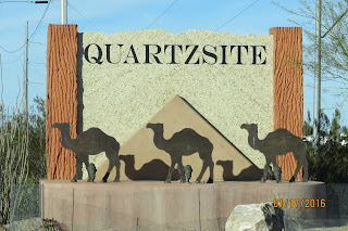
Quartzsite AZ: Bluegrass & RV Show

     On Thursday morning we departed Indian Wells Carefree RV Resort, and made the short drive across I-10 to Ehrenberg, NM.  It was only 120 miles or so, and as soon as we crossed the Colorado River at Blythe, CA, we arrived at our destination of Arizona Oasis RV Resort.
 Notice to GPS users: As we exited I-10, "Satellite Sue" our GPS, was directing us to turn left and cross over I-10.  The road first requires a right turn, into a roundabout, and then cross over I-10 to the south.  In the middle of recalculating, Sue froze up and had a meltdown.  That was kinda strange since we had been using her for a couple of years now, with no problems.  I decided to give her a second chance, and the following day, we drove the same route back to the resort, and she froze up a second time.  I guess she just doesn't like roundabouts???
     After getting our rig settled into our spot, our neighbor invited me over for a cold beer, and I decided almost immediately that I was going to like this place.  Mike and Iris are from Alberta, Canada, and were a welcome source of information around the area.
 Another young couple were visiting also, and even though we spent a few hours visiting around the campground, I never caught their names.  Is that embarrassing or what??  And we had so much in common with them.  They are from the Tampa, Fl area, and have been traveling around the country for several months now. Amazingly, they were camping at Meacham Lake during the manhunt for the escapees from Dannemora Prison!  I think there's going to be a pretty good chance that our paths will cross again, since we're both heading to South Texas and over to Florida.  We met another wonderful couple, Ben and Mary from Chino, Ca, on Mike's patio, and our last night in Quartzsite, we all went out for pizza and beer.  It would be really nice to meet up with them someday.  So the Arizona Oasis RV Resort gets a big thumbs up!
 
     We actually had 2 reasons to stop over in this part of Arizona.  We wanted to attend the 29th Annual Blythe Bluegrass Festival, in Blythe, CA and we wanted to checkout the RV Show in Quartzsite, AZ.  Friday morning we were up bright and early to get over to CA for the festival.  Our favorite bluegrass band,  The Gibson Brothers were putting on 3 shows, and they are always a pretty good time.  The weather was just a little cool, and there was just a slight breeze.  The snowbirds were pretty well bundled up, and Debbie actually brought along her wool sweater and jacket, and was just right.  The festival was utilizing 2 stages, so attendees were always able to find music to listen to.  This is a quiet festival.  There was no alcohol, but the snowbird crowd really seemed to enjoy the music from all the bands performing throughout the day.  As we walked the festival grounds between shows, Debbie spotted a booth selling Bonfire in a Can, which is actually a candle in a cookie tin.  Inside the can is a tightly wrapped cardboard roll soaked in about 9 lbs of paraffin.
      The website claims that it puts off a pretty good flame for heat, and when the paraffin burns away, we just need to place a block of paraffin on top of the rolled cardboard, and as that melts, the "candle" continues burning.  Sounds pretty easy, but we haven't tried it yet.  If it works, it will sure beat lugging firewood around.
     Saturday and Sunday we made the plunge into the RV Show in Quartzsite, AZ.  As we approached Quartzsite on I-10, a massive tent could be seen in the distance.  Exiting the highway, we began to understand what everyone told us previously about Quartzsite.  RV's of every shape and size were parked everywhere, with more traveling up and down the roads.  Jeeps, and ATV vehicles zigged back and forth across the road and into the desert, as everyone struggled to find a parking spot somewhere near the tent.  After a few trips through several parking areas, which were nothing more than desert/dirt roads, we managed to find a spot to park the Cherokee.
     A huge white tent was spread out in front of us, surrounded by hundreds of new trailers, 5th-wheel rigs, and RV's parked all around it.  Parking was free and admission was free, so how could we go wrong.  Entering the tent, we were met with thousands of people moving in a circle around every conceivable tool or gadget or anything, you could possibly need.   You could even get your concealed carry permit!
     People were doing a lot of shopping, and if you really needed something for your rig, you could find it here.  I was able to get some answers about my broken sewer hose, and Debbie scored a slicer/dicer that is going to get a big workout on our journey.  But the show didn't begin or end at the tent.  All around Quartzsite, every nook and cranny, it's a massive flea market on steroids happening. Anything you need can be found.  And rocks seems to be the hot commodity.
Everywhere, there are vendors selling rocks or crystals, some polished into jewelry, while others are just buckets of rocks.  That seems to be the snowbirds life out here in Quartzsite.   There are multiple RV parks around the town, but most choose to boondock on BLM land along the outskirts of town.  We had the impression that Quartzsite was going to be pretty wild in these campsites, but they seemed to be pretty well organized by BLM.  Each campsite was controlled by a Camp Host, and those camping on BLM land, need to sign in.  There didn't seem to be the massive numbers of campers out boondocking, and discovered that because of the weak Canadian dollar, they have decided to stay home.  It was quite evident, since there were lots of empty sites all around Quartzsite.
     Today we moved over to Benson, AZ where we will spend several days exploring the area.  We fueled Big Red for $1.89/Gal which truly amazed us.  If that price can continue for a few more months, that would be fantastic.  Debbie and I are still looking for some warm weather, and as I look around at the snow capped mountains all around us, I think we're gonna have to keep looking.  But there's lots to do here in Arizona, so we'll have to wait a little longer.